The Natura 2000 network of protected sites covers about 18% of the EU’s land area and is the main instrument to address nature conservation in Europe. It is the world’s largest coordinated ecological network of sites, set up based on the legal requirements of the European Habitats Directive and the Birds Directive. Specifically, grassland habitats are an important component of biodiversity in Europe. Agricultural intensification and abandonment of traditional management practices have put these habitats under increasing pressure. Although protective legislation has been put in place, it has not yet been possible to stop the regional decline of important grassland habitat types.
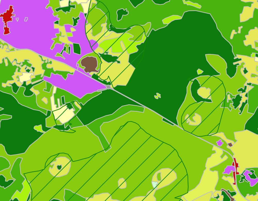
The Natura 2000 (N2K) element is part of the Copernicus Land Monitoring Service Components and focuses on these hot spots of biodiversity and human activity. ‘To assure that Natura 2000 sites are effectively preserved, harmonized information on land cover change dynamics and periodic monitoring across Europe is advisable’, explains Oliver Buck, project manager of EFTAS and responsible for the overall production and quality assurance, with respect to the main N2K benefits. The N2K service element provides comparable, pan-European and very-high-resolution (VHR) information on land cover and land use (LC/LU) status and changes over time for selected grassland-rich Natura 2000 sites across Europe, including a 2 km buffer zone around each protected site. The service differentiates 55 thematic LC/LU classes specified according to the MAES ecosystem types (Mapping and Assessment of Ecosystems and Their Services). All information is based on satellite image classification for the reference periods 2006 and 2012. The change mapping layer makes use of the LC/LU 2012 status information, applying a visual change interpretation using the VHR satellite imagery. It provides quantitative and qualitative information on land cover change dynamics between 2006 and 2012. The resulting LC/LU information will be used to support nature conservation in Europe, such as analyses on pressures and threats within Natura 2000 sites and in their surroundings.
The current survey is intended to complement and continue the previous mapping under the Copernicus Initial Operation phase (GIO) to a maximum area of around 470,000 km² until mid-2019. So far, EFTAS, GeoVille and GAF (together with its subcontractor Telepsazio Iberica) have provided the first 22,000 km2 according to schedule.
Contact:
EFTAS Fernerkundung Technologietransfer GmbH
Oststrasse 2–18
48145 Münster
Germany
info@eftas.com
www.eftas.com
GAF AG
Arnulfstrasse 199
80634 Munich
Germany
info@gaf.de
www.gaf.de
GeoVille Informationssysteme und Datenverarbeitung GmbH
Sparkassenplatz 2
6020 Innsbruck
Austria
info@geoville.com
www.geoville.com
EFTAS Remote Sensing Transfer of Technology GmbH – GeoIT precisely for your world.
As one of the leading GeoIT service Providers in Germany EFTAS realise sustainable solutions for our clients in industry and administration. State-of-the-art methods apply satellite data, aerial photography and GNSS-based field surveys. Worldwide. Owner-managed. Since 1988. Eco- and ISO 9001-certified.
EFTAS Fernerkundung Technologietransfer GmbH
Oststraße 2-18
48145 Münster
Telefon: +49 (251) 1330-70
Telefax: +49 (251) 13307-33
http://www.eftas.com
Telefon: +49 (251) 133070
E-Mail: oliver.buck@eftas.com